Georeferenced maps in the State Library of Victoria's collections
This dashboard provides information on digitised maps from the State Library of Victoria's collection that have been georeferenced using Allmaps. It is updated every two hours. Check Allmaps Latest for more recent additions.
See the project documentation for information on how you can be involved!
Latest georeferenced maps
You can explore the full list of georeferenced maps using Datasette or the Georeferenced maps explorer.
Here are the locations of the 20 maps most recently created or modified. Click on a highlighted area for more information.
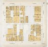
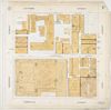
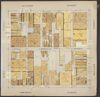
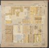
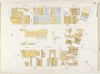
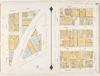
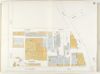
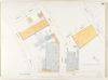
Here are the details of the 20 maps most recently created or modified.
| thumbnail | manifest_title | map_title | modified | allmaps_link | slv_link |
|---|---|---|---|---|---|
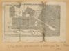 |
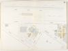
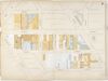
Map of Melbourne and Collingwood / | Image H32088/89 | 2026-06-25 05:16:14.648000+00:00 | View in the AllMaps viewer | View in the SLV viewer |
 |
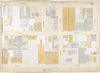
The most complete popular & mercantile map of Melbourne, Victoria giving most useful information as to the government, law courts & corporation buildings, the vacant grounds, the numbering of the houses from one corner of the street to another, the banks, insurances, auction rooms, markets, churches, chapels, schools, theatre, circus, concert halls and hotels &c. &c. / | Map 1 | 2026-06-01 01:50:10.805000+00:00 | View in the AllMaps viewer | View in the SLV viewer |
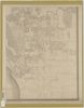 |
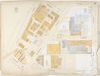
Melbourne and its suburbs | Map 4 | 2026-06-01 01:26:25.322000+00:00 | View in the AllMaps viewer | View in the SLV viewer |
 |
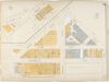
Melbourne and its suburbs | Map 3 | 2026-06-01 01:22:58.569000+00:00 | View in the AllMaps viewer | View in the SLV viewer |
 |
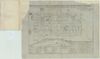
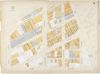
Melbourne plans. Section 2 | Map 2a | 2026-05-27 11:59:14.420000+00:00 | View in the AllMaps viewer | View in the SLV viewer |
 |
Melbourne plans. Section 2 | Map 1a | 2026-05-27 11:48:13.427000+00:00 | View in the AllMaps viewer | View in the SLV viewer |
 |
[City of Melbourne plans. Section 2] | Map 2a | 2026-05-20 11:41:22.027000+00:00 | View in the AllMaps viewer | View in the SLV viewer |
 |
[City of Melbourne plans. Section 2] | Map 1a | 2026-05-19 11:58:39.078000+00:00 | View in the AllMaps viewer | View in the SLV viewer |
 |
South Melbourne plans | Map 17 | 2026-05-18 12:22:30.743000+00:00 | View in the AllMaps viewer | View in the SLV viewer |
 |
South Melbourne plans | Map 16 | 2026-05-18 12:18:48.069000+00:00 | View in the AllMaps viewer | View in the SLV viewer |
|
South Melbourne plans | Map 16 | 2026-05-18 12:18:48.069000+00:00 | View in the AllMaps viewer | View in the SLV viewer |
 |
South Melbourne plans | Map 15 | 2026-05-18 11:57:48.033000+00:00 | View in the AllMaps viewer | View in the SLV viewer |
 |
South Melbourne plans | Map 14 | 2026-05-18 11:54:30.399000+00:00 | View in the AllMaps viewer | View in the SLV viewer |
 |
South Melbourne plans | Map 13 | 2026-05-17 11:52:04.783000+00:00 | View in the AllMaps viewer | View in the SLV viewer |
 |
South Melbourne plans | Map 12 | 2026-05-17 11:43:17.319000+00:00 | View in the AllMaps viewer | View in the SLV viewer |
 |
South Melbourne plans | Map 11 | 2026-05-16 11:54:45.759000+00:00 | View in the AllMaps viewer | View in the SLV viewer |
 |
South Melbourne plans | Map 10 | 2026-05-16 11:50:53.806000+00:00 | View in the AllMaps viewer | View in the SLV viewer |
|
South Melbourne plans | Map 10 | 2026-05-16 11:50:53.806000+00:00 | View in the AllMaps viewer | View in the SLV viewer |
 |
South Melbourne plans | Map 9 | 2026-05-16 11:40:11.838000+00:00 | View in the AllMaps viewer | View in the SLV viewer |
 |
South Melbourne plans | Map 8 | 2026-05-15 11:59:42.012000+00:00 | View in the AllMaps viewer | View in the SLV viewer |